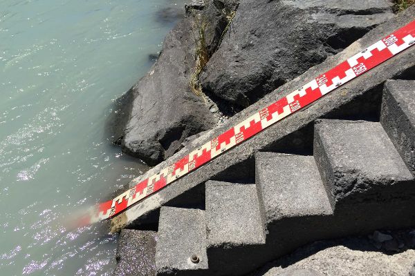
What is the Austrian Hydrography (Hydrographie Österreich)?

The Austrian Hydrography has been operating for more than 100 years a measuring network with the goal of making available data for the Austrian water cycle.
History of Hydrography
In the course of the 19th century waters were increasingly used for navigation as well as for commercial and industrial purposes. The water demand in settlement areas was also permanently rising. As a reaction on it the Hydrographic Central Bureau was established as a special department of the Supreme Building Authority in 1893. The available hydro-technological documents should be evaluated and new data gained from the operation of monitoring stations should be collected.
After the establishment of a monitoring network comprising the whole monarchy the Hydrographic Central Bureau considered it its most important task to collect data relevant for water management, to check them, and to process them for questions relevant for water management.
Perception in case of extraordinary events
It was due to the disastrous flood events in 1897 and 1899 that the development of the hydrographic measuring and information system on Austrian territory was promoted and attention was paid to the then still “young” hydrological science, and the establishment of a flood news service for the Danube was accelerated.
Afterwards measuring networks have been developed in order take account of the changing needs and requirements. In accordance with the phases identified by Emmenegger (1990) for Switzerland predominantly the following periods can be mentioned:
| 1850 until today | Flood Control |
| 1900 to 1960 | Development of hydroelectricity |
| 1960 until today | Utilisation of the available groundwater |
| 1970 until today | Water pollution control |
| 1980 until today | Contribution to environmental monitoring |
| 1990 until today | Effects of climate change |
With the Federal Act of 30 July 2025 the former Ministry of Agriculture took over the tasks of the Hydrographic Service.
Hydrography as a government task was carried out until the entry into force of the Federal Act on the Monitoring of the Water Cycle and the Quality of Water (Hydrography Act) in 1979 by means of the application of the organisational statute of 1894. With the Amendment to the Water Rights Act in 2003 the tasks of hydrography were incorporated into the Water Rights Act and the Hydrography Act was overruled.
For more than hundred years the Hydrographic Service has now been monitoring the components of the water cycle in Austria as well as the related phenomena in their spatial and temporal sequence.
Organisation
The Hydrographic Service Austria consists accordingly of Directorate I/3 - Water Balance (HZB Hydrographic Central Bureau), the hydrographic organisational units in den Federal Provinces and viaDonau - Österreichische Wasserstraßen-Gesellschaft GmbH, (Austrian waterways operator) as well as of a great number of observers which control the measuring sites on the spot.
Directorate I/3 - Water Balance is in charge of the coordination of the standardized data collection, quality control, the evaluation and the publication of hydrographic information and is the link between hydrologic research and the practice of data collection. The operational work on the measuring site is carried out by the hydrographic organisational units in the Federal Provinces, which also supervise and coordinate the important work of the observers.
Hydrography or Hydrology?
In Austria hydrography has been understood for years as the part of hydrology which deals with the quantitative recording and description of the water cycle on, below, and above the earth’s surface and which deals with the related questions. This definition, which is known in Austria and in Switzerland is, however, unusual in Germany, and does not fully comply with the meaning of the English word hydrography - which rather means the measurement of the form of riverbeds, lakebeds and seabeds (sea measurement, water measurement), however, it is maintained for historical reasons.