Run-off predictions of Hydrographie Österreich (Hydrography Austria)
The hydrographical organisational units in the Federal Provinces operate complex calculation models in order to warn the population against flood hazards.
The flood predictions constitute a core element of the control of measures of preventive flood protection within the action cycle of an integrated flood management (picture 2 of the gallery). Even more than 100 years ago, the need to operate a flood information service was identified and, on the occasion of the big flood events along the Danube at the end of the 19th century, it was established in Austria for the first time.
Requirements
The requirements placed on the hydrological forecast have considerably changed in the course of the past 100 years due to the settlement of our valley areas and the related increased risk of damage. Whereas 100 years ago it was only the Danube area for which a flood information service was considered to be important, nowadays prediction models are in operation at almost each larger body of water in Austria, which are permanently calculating the current run-off situation and run-off predictions for a period of up to two days in advance (prediction models in Austria, see picture 5).
The big damage caused by the flood events in 2002, 2005 and 2013 has shown clearly that for the predictions as well as for the event analysis a hydrographical monitoring measuring network is indispensable.
In particular in the course of the past 15 years the model structure has changed considerably. More or less simple, event-related correlation models have been replaced by water balance models which are permanently in operation. The requirements for the input data and the data management of the model operators necessary for this purpose have increased enormously due to this fact (picture 3).
At this point it has to be emphasized that the hydrological predictions in Austria constitute a task of the public service and are carried out by the hydrographical organisational units in the Federal Provinces.
Benefits of the flood forecast
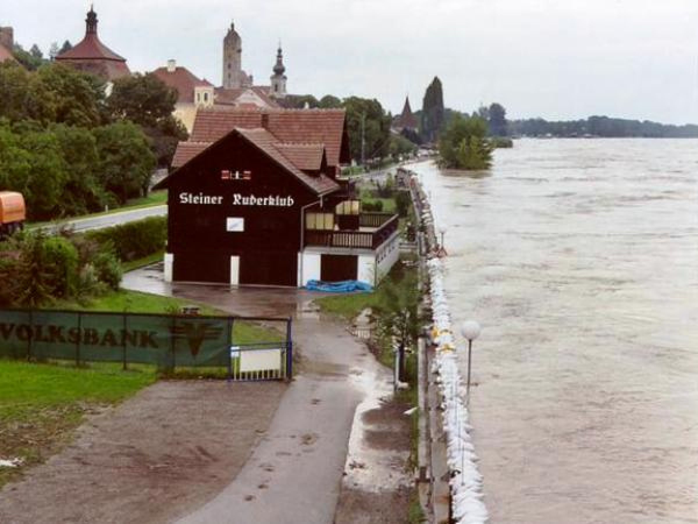
It is difficult to express the value of a reliable forecast in figures. For example the flood at the Danube in 1991 had a probability of occurrence of approximately 25 years and caused in Stein-Krems damage amounting to about 6 million euros. The mobile flood control established for this section of the river Danube in the 1990s costed about 12 million euros and has prevented in the course of the past 15 years alone flood damage costs exceeding the investment sum many times.
Mobile flood control works only in connection with a hydrological flood forecast and a pre-warning time, which enables the construction in the case of every potential damaging event. As mobile flood control along the Danube - in particular in the Wachau region - constitutes the only possibility of protection without impairing the scenery, villages in the Wachau (Weißenkirchen, Spitz and Mautern) are protected against floods by a mobile facility. Only with reliable forecasts and the cooperation of hydrography and task forces can such facilities be operated for the protection of the population.
How to get flood information?
Every hydrographical organisational unit in the Federal Provinces offers on the internet current information and data on the water balance within its own sphere of competence. The data of almost all measuring sites, which are equipped with a data transmission facility, are transmitted via the hydrografischen Datenverbund (hydrographic data network) to the Federal Ministry for Sustainability and Tourism, now Federal Ministry of Agriculture, Regions and Tourism. Directorate IV/4 - Water Balance (HZB Hydrographisches Zentralbüro - Hydrographical Central Office publishes in cooperation with the Computing and Technology Centre of Agriculture and Forestry (Land- und Forstwirtschaftliches Rechenzentrum LFRZ) a WEB-GIS internet website on which a summary of this current information is presented. This website contains also links to the pages of the Federal Provinces.
The Hydrography Offices in Salzburg, Lower Austria, Styria (level at the Mur and the Raab rivers)and Upper Austria (level at the Danube) are those offices of Federal Provinces which are permanently presenting - also in the normal case - the run-off forecasts for the levels of the hydrographical measuring network on the internet. In Lower Austria a differentiation is made in the presentation of the predicted run-offs between the predicted levels at the Danube and the levels at smaller river basins. For the Danube the currently measured hydrographs and the forecasts up to 48 hours into the future are represented. In addition to the most probable forecast an upper and lower region of confidence is indicated as well (picture 4). The result of the forecast for the river Thaya in the Waldviertel region - which is made available by the Czech hydro-meteorological service - is represented as well in the form of hydrographs on the internet. For the forecast levels of the smaller river basins in Lower Austria a block representation has been selected for the visualisation of the results on the internet, which is to show the area of possible development.
All hydrographical services in Austria publish in the case of floods warnings and status quo reports on the internet.
Persons concerned by floods or living with the risk of floods should, if the event occurs, also pay attention to the warnings of the weather services (ZAMG, Zentralanstalt für Meteorologie und Geodynamik Central Institute for Meteorology and Geodynamics), ORF (Austrian Broadcasting Corporation), in order to be able to carry out in time measures to limit and/or to prevent damage.
Information which areas in Austria are exposed to flood risk are available on the internet at http://www.hora.gv.at/.
Links to run-off information of neighbouring countries
Links
- Hydrography Burgenland (in German only) Hydrography Burgenland (in German only)
- Hydrography Lower Austria (in German only) Hydrography Lower Austria (in German only)
- Hydrography Upper Austria (in German only) Hydrography Upper Austria (in German only)
- Hydrography Salzburg (in German only) Hydrography Salzburg (in German only)
- Hydrography Tyrol (in German only) Hydrography Tyrol (in German only)
- Hydrography Vorarlberg (in German only) Hydrography Vorarlberg (in German only)
- Hydrography Carinthia (in German only) Hydrography Carinthia (in German only)
- Hydrography Styria (in German only) Hydrography Styria (in German only)
- To the flood forecast Mur and Raab (in German only) To the flood forecast Mur and Raab (in German only)
- eHYD (in German only) eHYD (in German only)
- Central Institute for Meteorology and Geodynamics (in German only) Central Institute for Meteorology and Geodynamics (in German only)