HORA 3D - The new form of risk communication
HORA, the interactive map of natural hazards in Austria, becomes HORA 3D. The step from two- to three-dimensionality makes risk visualisation more vivid and realistic for the Austrian population - a unique project worldwide.
Due to an accumulation of major flood events in the last two decades, an increasing sensitisation of the population combined with a growing interest in publicly accessible information on natural hazards and their management can be seen. Together with a team from science and research, the Federal Ministry of Agriculture, Forestry, Regions and Water Management (BML) is very successful in this area with a variety of awareness-raising measures, in particular the HORA natural hazard platform, which has been successful for more than seventeen years. The latest modelling approaches combined with constantly improving computer performance contribute to the fact that new standards are constantly being set with the expansion and ongoing updating of the extensive map series.
The aims of HORA are to sharpen risk perception, develop public awareness of natural hazards and encourage people to take precautions themselves. HORA thus represents a supplement to the relatively complex but parcel-specific hazard zone plans in hydraulic engineering. Conceived as a public-private partnership, the Federal Ministry of Agriculture, Forestry, Regions and Water Management (BML) and the Austrian Insurance Association (VVO) launched the HORA project shortly after the catastrophic flood of the century in 2002. Since then, it has developed into an internationally recognised showcase project for the presentation of natural hazards and has also received several awards. The platform has been expanded in recent years to include numerous natural hazards such as earthquakes, landslides, storms, lightning, hail and snow and also contains up-to-date weather information on floods (current water levels of more than 250 water gauges) and, thanks to a co-operation with Geosphere Austria (formerly ZAMG), also on earthquakes, storms (daily updated wind peak maps for the whole of Austria), hail, lightning and snow. Almost half a million application calls and more than two hundred thousand downloads of HORA passes in 2022 show that clearly understandable natural hazard information is in demand and accepted by the general public.
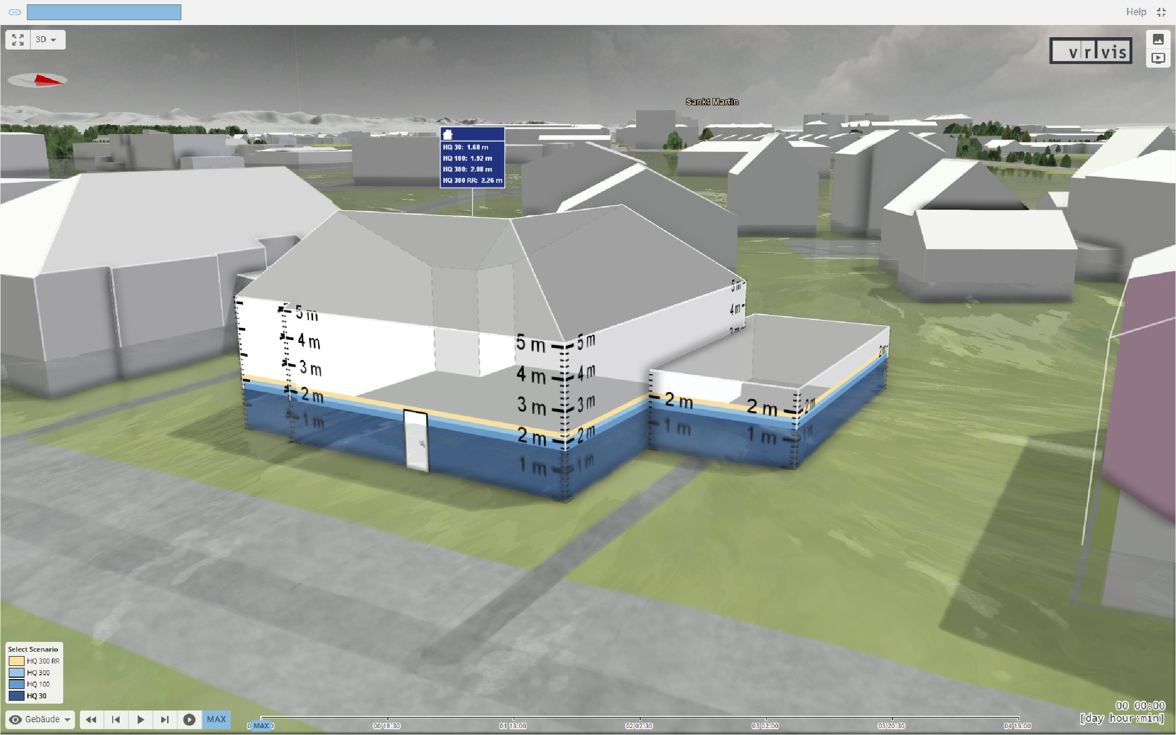
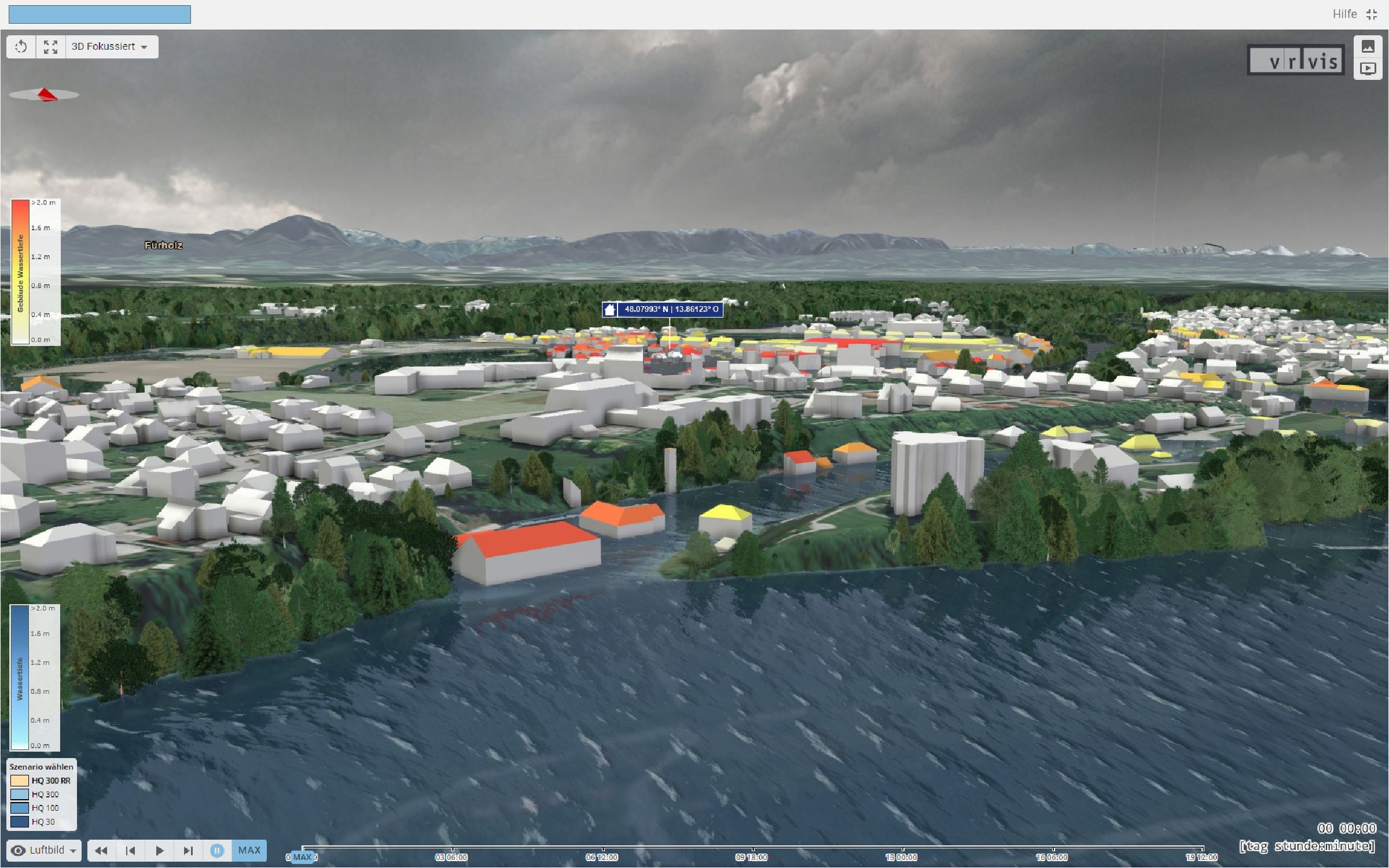
The HORA 3D now available shows the completely new interactive map of the two-dimensional HORA 3.0 data with online simulations of various flood events, from thirty-year to three-hundred-year events. This requires enormous technical computing power and the processing of huge amounts of data. Thanks to the high-resolution, hydrodynamic simulations, the flood risks along almost forty thousand kilometres of river can now be made more comprehensible and intuitively understandable for the population within a few seconds in interactive and extremely detailed 3D scenarios. The step from two- to three-dimensionality taken now in HORA 3D changes and redefines the entire risk communication with the Austrian population in the area of natural hazards.